Cankiri Short Facts Cankiri This city, formerly known as Gangra, has a long history. This settlement, which came under the rule of states such as Paphlagonia, Pontus, Galatia; Afterwards, it took place between Roman and Byzantine lands. Çankırı and the surrounding lands were ruled by Danişmendoğulları after 1071. During the Ottoman Empire, it was included in the territory during the reign of Murat the First. Çankırı, which was a center affiliated to the Anatolian province during the Ottoman period, came to the fore as a part of Kastamonu together with the Republic. However, considering that it became an important transit point in the War of Independence, it was decided to become a province. Cankiri Çankırı Climate and Vegetation The continental climate is seen in Çankırı. While a cooler winter period passes in Merkez, Ilgaz and Yapraklı; It is stated that the conditions of the Çerkeş district are even more severe. Throughout Çankırı, precipitation occurs in every season. Çankırı also draws attention with its forests. It is possible to come across different tree species in this region. Larch, Scotch pine, juniper, oak, spruce, fir, pear and dogwood trees are located in the forests. At the same time, it is possible to come across willow and poplar trees along the water sources. Wild animals are also frequently encountered in the region. Wolf, fox, rabbit, partridge and squirrel occur in large numbers in these natural areas. An effective struggle was put forward against wild boars throughout Çankırı, and a decrease in their number was ensured.
@sehirtanitim
Joined 28 April 2022 · 18 posts
120 KT
0 KT · 14¢ received · 0 KT · 46¢ given
Posts
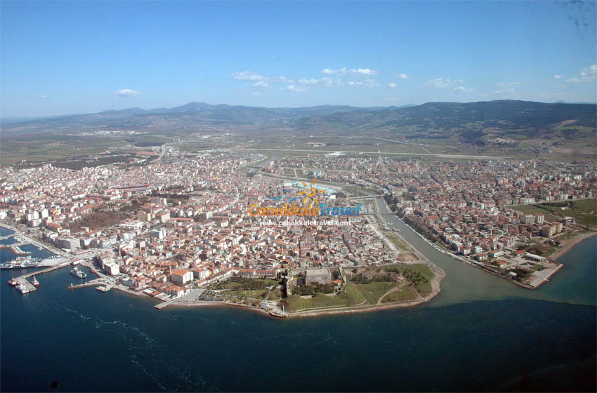
Çanakkale Guide! Çanakkale, which was known as Hellespontos and Dardanel in ancient times, was founded in BC. It has been a residential area since 3000 years. Çanakkale, which has been an important settlement since the Early Bronze Age; Thanks to the Dardanelles, it is one of the two passage regions that provide the connection between Anatolia and Europe and between the Mediterranean and the Black Sea. Due to this feature, it has a very rich history. It has provided economic and military superiority to the communities living in the region, and they have surpassed their contemporaries in the field of civilization. However, this situation has made the region the target of various migration and invasion movements. There were people who came to the region to settle or plunder on different dates, and in both cases, certain cultural exchanges were intensified. This cultural mixing continued with interruptions for centuries, and as a result, a very colorful cultural mosaic emerged. In the narrowest part of the Bosphorus, during the reign of Mehmet the Conqueror, castles called Kilitbahir around Sestos on the Rumeli side, and Sultaniye (Kale-i Sultaniye) or Çanak Castle around Abydos on the Anatolian side were built. The name of today's Çanakkale Province comes from the Çanak Castle on the Anatolian side. The oldest people of the region are the indigenous people of the Chalcolithic Period, known from the Beşiktepe and Kumtepe settlements. These, I.O. From the 3000s to the 1200s, the people of Troy continue their lives without any external influence. After that, various tribes came with the Trojan Wars, the Achaeans, and the Aegean migrations, respectively. Finally, after the death of the Sicilian Commander Roger De Flor, the Catalonians under his command continued their activities for a while, but later on, as per an agreement they made with the Turks, they left Çanakkale and its region to the Turkish Beys. B.C. Founded in 3000, Troia I, BC. It was destroyed by an earthquake in 2500 years. It is known that there were ancient settlements in the region before that. It is thought that the city of Dardanos was founded before Troy I. Its establishment priority is around 100-150 years. B.C. With the migration of "Sea Peoples" from the north in the 1200s, a dark period began in the region and in Anatolia in terms of written history. Region, BC. In the 7th century, it was dominated by the Lydian Kingdom, which became a great power in Western Anatolia, BC. With the arrival of the Persians in the 5th century, Persian influence began to increase. With the "King Peace" made between the Persians and the Spartans in 386, Persian domination was assured in the region. B.C. In 334, when the Macedonian King Alexander the Great defeated the Persian army near the Biga Stream (Granikos), Persian dominance began to decline in Anatolia. After the death of Alexander, Alexander's commanders engaged in a power struggle in the region. After the domination of the Pergamon Kingdom and the invasions of Galatians, Dictator Sulla came to Gallipoli during the efforts of Rome to establish dominance in the region. The region gained importance with its ports during the Roman and Byzantine periods. The Ottomans' desire to establish dominance in the Mediterranean led them to start the conquests in the Balkan Peninsula from Gallipoli and its region. With the establishment of a shipyard in Gallipoli, the Ottoman dominance in Çanakkale increased even more. The Importance of the Bosphorus came to the fore once again in the Dardanelles Wars (World War I) and the enemy navy was defeated on March 18, 1915. GEOGRAPHY Çanakkale is located on both sides of the Bosphorus, which separates the European and Asian continents from each other in the northwest of Turkey and bears its name. Balıkesir is located in the east and southeast of Çanakkale, there is the Aegean Sea in the west, Edirne in the northwest, Tekirdağ and the Marmara Sea in the north. The province has lands in the Aegean and Marmara Regions. Its surface area is 9737 square kilometers and its coastline is 671 kilometers. Due to its location, it shows a transitional climate between the Mediterranean and Black Sea climates. Rainfall is generally seen in spring and winter. ITS POPULATION The population of Çanakkale is 511,790 according to the 2014 census. With a population density of 52, Çanakkale ranks 43rd among other cities in terms of total population size. ECONOMIC STRUCTURE Although agriculture is the most important activity in the provincial economy, agriculture-based industries have developed in recent years and the share of industry in the economy has increased accordingly. 73,563 of them work in the services sector. Unemployment rate in the province is 3.6%. Forests cover 54%, agricultural land 34%, meadows and pastures 5%, and non-cultural lands 7%. 81% of the agricultural land is field land, 6% is vegetables, 2% is fruit, 2% is vineyards, and 8% is olive groves. The total agricultural area of the province is 330,337 Ha. and 120.000 Ha. is irrigable land. A total area of 60,711 ha (50.6%) is irrigated, and 39,457 ha (65%) of this irrigation is carried out by the state. Grain takes the most important place among the agricultural products grown, both proportionally and as cultivation area. ASSOS It is in Behramkale village of Ayvacik district. It is thought to have been founded by the Methymnas from Lesbos in the VII century BC. Established on a hill that dominates both the sea and the land, the Acropolis is 3 km. is long. Doors made in different ways are interesting. The Temple of Athena, which was built on its highest place, the Agora where the official structures of the period are located, the lectern, the Bouleterion (Assembly) consisting of statues and small monumental structures, the Gymnasium, Theatre, the Stoa and the Necropolis from the Hellenistic-Roman periods are the most important parts of the Acropolis. Also in Ayvacik District; Cyryse in Gülpınar Gardens, Temple of Apollo Simintheus, one of the three temples in Anatolia whose columns are decorated with figured tanburs (others are Temple of Ddyma Apollo and Ephesus Artemis), Adatepe Zeus Altar mentioned in Homer's Iliad, Roman bridge in Gülpınar Subdistrict, Babakale Mosque in Babakale, built by Kaymak Mustafa Pasha in the 17th century, Behramkale Village Hüdavendigar Mosque built on a high hill near the ruins of Assos, and Behramkale Bridge built of local stones, built on Tuzla Stream, are worth seeing. BC Vll . There are always vehicles from Çanakkale to Assos City Ruins, which was founded in the 19th century and where Aristotle opened the School of Logic.
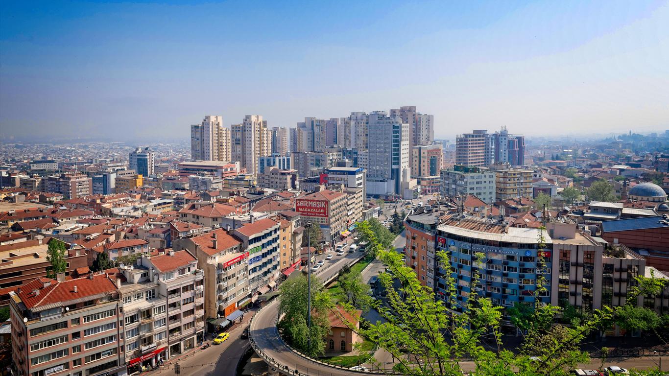
Bursa City! Bursa History Bursa and its surroundings, one of the paradise corners of Anatolia, the cradle of civilizations, have been the scene of settlements since ancient times. It was revealed during the excavations of the Ilıpınar Tumulus that the civilizations created by the old settlements in the region went back 7 thousand years. As a result of the excavations in the mound, BC. A settlement dating back to 5200 years ago was found. 7 km from Bursa. north of Demirtaş township, 2.5 km. south, 90 m. circumference of 5 m. “Demirtaş Tumulus” with a height is located. In this mound, there are pottery fragments of bowls, jars and jugs made by hand, and a small amount by wheel. These are from the early bronze age and date back to BC. It is dated to the 2500s. Bursa Conquest Gate The dimensions of "Çayırköy Mound", 14 km west of the city and 1 km southwest of Çayırköy, are the same as Demirtaş Mound. The ceramic pieces found here are dominated by gray, red, brown and black colors. Most of the pottery fragments found were made by hand, and very few of them were made on wheels. The oldest find of the mound dates back to BC. It belongs to the year 2700. B.C. The first name of the city, which was founded by the Bithynians and Prusias in the 3rd century, was “Prusa”. The oldest settlements of Bursa and its surroundings, which are also referred to as "Bitinya" in written sources, are around Lake Iznik. Only around Lake Iznik, there are seven important mounds that seem to have been founded in the stone ages. Ilıpınar near Orhangazi and its 750 m. Hacılartepe Mound to the east, Tepecik Mound at Yeniköy sub location on the Orhangazi-İznik road, and Körüstan, Üyücek Tepe, Höyücek and Karadin mounds to the east of İznik Lake. In the city center of İnegöl, Cumatepe mound and Doğutepe Akhisar mounds 3 km east and Yenişehir Babasultan Mound indicate prehistoric settlements. The ruins in Demirtaş Village Mound, Dorak Village and Tahtalı Village in M. Kemalpaşa indicate that the Bursa region has been an important civilization area for at least five thousand years. Bursa and its surroundings were previously called Bithynia. The south and west of Uludağ were called Mysia. The Bithynians living in the Bursa region were of Thracian origin. Because it was located on the crossing point of Asia and Europe, very different peoples settled in the region. Before the Bithyns, the Bebryks lived in the area. Then the Mysi came. The Bithyns are often referred to as Asian Thraks because of their adherence to Thrak customs and traditions. It is understood from the documents that the language they use is Thracian. However, with the influence of the Greek colonies, the people of Bithynia gradually became Greek. Before the Bithyns, Bebryk was spoken in the region and Mygdon in the east. In the west, the Mysia language was spoken. It is known that the Byzantines settled many Serbs and Bulgarians in Bursa and its vicinity in the 12th century. When the Ottomans came to this region, they found Orthodox Christians in Bursa and its environs, from very different ethnic groups. It should also be stated that when the Ottomans took Bursa, the city consisted only of a fortress. Orhan Gazi took the city out of the fortress and established a new city outside the walls, forming the core of today's Bursa. Public buildings such as schools, hospitals, bridges, soup kitchens, caravanserais, and baths were built and the foundations of today's “Green Bursa” were laid by creating residential areas around them.
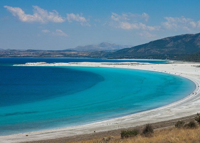
Burdur Burdur Burdur, which was called Psidia in ancient times; It is a city that has been under the domination of the Turks since 1071. It was also stated that this city, which was first known as the center of the Hamitoğulları Principality, joined the Ottoman lands during the reign of Yıldırım Bayezid. In 1852, he had the chance to become a sanjak. Although its only district was Tefenni until 1926, it kept 10 districts within its borders over time. Apart from Tefenni, Yeşilova, Bucak, Gölhisar, Ağlasun, Karamanlı, Kemer, Altınyayla, Çavdır and Çeltikçi are also among its districts. The city of Burdur, which has a history dating back to the Greek period, also has a very interesting natural beauty. In this way, it can be seen as an important city in terms of tourism. Burdur Geography The altitude of Burdur province is defined as 100 meters. It includes Boncuk Mountains, Elmalı Mountain, Katrancık Mountain, Kuyucak Hill and Dedegöl Mountain. At the same time, there are some lakes belonging to the Lake District in this region. Burdur Lake and Acıgöl can be counted among them. Next to the borders of Burdur, there are Antalya, Denizli, Muğla, Afyon and Isparta. It is stated that Burdur province is generally hilly. Approximately 61% of it is called mountainous. Since it is a city built on the extensions of the Western Taurus Mountains, it is quite rugged. Soil structure is also called as calcareous and clayey. However, being close to holiday spots is also among the reasons for preference.
Bolu City Bolu Province The oldest known history of the province of Bolu, located in the Black Sea Region of Turkey, dates back to 1200 BC. Bolu, which hosted the Hittites, Alexander the Great, Persians, and the Ottoman Empire, has taken on a different identity with its unique customs and traditions over the years. History of Bolu B.C. In the 1200s, Bolu, like all Hittite lands, was in the hands of the Phrygians. B.C. In the 6th century, the Persians dominated the region. B.C. In 336, Alexander the Great defeated the Persians and captured Bolu, like many other parts of Anatolia. When Macedonia collapsed upon the death of Alexander the Great, the Kingdom of Bithynia was established in the Bolu region. According to written documents, archaeological artifacts and historical sources from those times, the people who settled in the arc of Sakarya and Filyos Rivers at the end of the Thracian migrations were called "Bithyn". That's why Northwest Anatolia, including Bolu, was called "Bithynia". Bolu Plain and its surroundings, called Salonia Campus by the Bithyns, were changed to "Claudio Polis" by the Romans. Bolu Map It is thought that the name Bolu comes from "Police". The city, which was built on three hills, had inner and outer walls. Remains of these walls can be seen in the Carpet Fortress area in the north of the city. After the 1071 Malazgirt victory, the Turkmens who spread to the west settled in Bolu 3 years later. The commanders of the Seljuk State Artuk, Tutuk, Danişmend, Karateki and Saltuk Beys, under the command of Süleyman Shah, reached the border of Istanbul. During these raids, Bolu was conquered by the Horasanlı Aslahaddin. The Ottoman invasion of Bolu Region was started by Osman Gazi for the first time. The complete conquest of the Bolu region coincides with the first years of the Orhan Gazi period (1324 – 1326). According to another rumor, the region was named as "Bol Uluğ" in the past, and as "BOLU" in time, due to the abundance of Uluğ - Scholar in the region during the Ottoman period. Bolu was the scene of the war of princes, which started with the death of Yıldırım Beyazid, many times. Bolu was not only outside the areas plundered by Timur after the Battle of Ankara, but also became the town that hosted Çelebi Mehmet, who was considered the second founder of the Ottoman Empire, on the Kızık Plateau until this danger was over. After Çelebi Mehmet ensured the unity of the Ottoman Empire, Bolu gained a regular administration. Bolu Yildirim Bayezid Bath Between 1324 and 1692, Bolu was a sanjak principality with 36 districts. XVI. In the 19th century, Bolu became one of the second degree Şehzade sanjaks. During the reign of Bayezid II, Prince Süleyman (Kanuni) was appointed here. Between 1683 and 1792, Bolu was ruled by voivodeship. II. During the reign of Mahmut, it was transformed into a governorship. (1811) Bolu after the Tanzimat; It was attached to Kastamonu province (1864). In 1909, it was converted to the governorship again. After the Armistice of Mudros entered into force and İzmir was occupied, the first Defense of Law Society in the Bolu region was organized in Gerede. Bolu was not invaded by the enemy during and after World War I, but it suffered material damage. At the end of the periods of national struggle under the leadership of Mustafa Kemal Pasha, Bolu completed the period of governorship on October 10, 1923 and became a province.
Bitlis City Located in the Eastern Anatolia Region of Turkey, one of the greatest treasures of the province of Bitlis is Mount Nemrut and Nemrut Crater Lake. In addition, Ahlat district has witnessed many historical events. Especially when the Turks entered Anatolia, it hosted Alp Arslan and his army. Apart from all these, its unique dishes, historical places, museums and geographical structure add a different beauty to Bitlis. Bitlis History Located in the Eastern Anatolia Region, Bitlis is to the west of Lake Van. Its name comes from Bedlis, one of the commanders of Macedonian King Alexander the Great, who had the castle built in the city. It is known as the "Beautiful City in the Valley" because it was founded in a valley where historical buildings are predominant. Bitlis was the settlement area of the Urartians in 400 BC. 11 BC. Bitlis, which continued to be the homeland of the Urartians until the 7th century and was under the rule of the Assyrians until the 7th century and the Medes until the 6th century, was later captured by Darius II with the establishment of the Persian Kingdom. BC4. century, which came under the rule of Alexander the Great, King of Macedonia, and A.D. 2. Bitlis, which was captured by the Eastern Roman Emperor Trayan in the 7th century, remained under Byzantine rule until the 7th century. Bitlis map Bitlis, which became an important haunt during the Anatolian raids of the Turks that started with the 10th century and hosted Alparslan and his armies in Ahlat during these dates, also assumed a very important role in the opening of the Turks to Anatolia. Bitlis, which was attacked by the Ayyubids in the 13th century and later by the Harzemshahs and Mongols, and came under Ottoman rule with the Battle of Çaldıran in 1514, became a center of science, art and culture under the administration of the Ottoman Empire. Bitlis, which was under the occupation of Tsarist Russia for a while during the First World War, was made a province after the proclamation of the Republic. In Bitlis, which has embraced various civilizations throughout history, there are many castles, mosques, madrasahs, bridges and caravanserais belonging to these periods. For this reason, it is possible to live side by side with the cultural and artistic remains of past civilizations. More than half of Lake Van, which was formed by the eruption of Nemrut Volcano, is within the borders of Bitlis Province. Tatvan, Ahlat and Adilcevaz Districts integrate the beauties of the Van Lake shores with their own historical features. Especially in Ahlat, which was under the Seljuk rule for many years, the world-famous mausoleums and tombstones, in Adilcevaz District, the Urartians and especially Kef Castle form the rings of the historical richness of the province. Where Did the Name of Bitlis Province Come From? It is not known exactly where the name of Bitlis used today originates from. Bitlis has been called by different names throughout history. Assyrians used it as Bit-Liz, Persians and Greeks as Bad-Lis or Bad-Lais, Byzantines as Bal-Lais-on, Babaleison or Baleş, Arabs as Bad-Lis, Armenians as Pageş or Pagishi. In the Assyrian language, the word Bit means yurt, the word Bet means castle, Bit-Liz means Liz's Dormitory, and Bet-Lis means Liz's Castle. bitlis castle The event that historians unanimously focus on regarding the name Bitlis is as follows; B.C. King of Macedonia II in 336. Plovdiv died and Alexander the Great succeeded him as king. (In the Şerefname, Alexander the Great of Macedonia claims that Alexander the Great, known as the prophet, is Alexander Dhul-Qarnayn. Since Dhul-Qarnayn means "two horns", he argues that Dhul-Qarnayn was Alexander the Great because he constantly moved to the east and died at the age of 31. Alexander the Great also understands. It has been suggested that they are the same people because two horns of flesh appeared, made expeditions to the east and died at the age of 30. However, these ideas have not been proven until today.) Alexander, who invaded Babylon, decided to go on an expedition to India with his armies. In the meantime, two horn-like pieces of meat came out of Alexander's mind, and he had to constantly use a horned helmet to hide it from his entourage. All the physicians he talked to for a solution to his problem recommended that his cure is in the waters and that he should use the waters wherever he went. For this reason, Alexander the Great sought a solution to his problem by washing his face in the waters wherever he visited. When he arrived in Şattülarap, he wanted all the waters flowing into the Tigris river to be investigated, and assigned the scholars to this task. Searching all the waters, Alexander and his nature came to Bitlis after a long walk. Seeing that the Bitlis tea cured his illness, he established his headquarters at the junction of Köşür and Rabat waters. The physicians under his command told Alexander; They wanted the water to go to its source. Following this recommendation, Rabat water flowing from the east of Bitlis was followed and the source of the water was reached. However, despite using this water for days, he saw that there was no cure, this time he turned to Kösür stream, which came from the west of the city, and finally reached the spring, which is the source of this water. Found this spring
Bingöl City Introduction The oldest known history of Bingöl, located in the Eastern Anatolia Region of our country, dates back to BC. It is the year 2000. Its first known name is “Cebel-cur”, which consists of the words “Cebel” meaning “mountain” and “cur” meaning “flowing”. It has hosted many civilizations from the Hittites to the Romans, from the Ottomans to the present day. With its mountains, caves, hot springs and natural beauty, it takes on another beauty in summer, another in winter, and another in spring and autumn. Where did the city of Bingöl get its name? The oldest known name of Bingöl is Cebel-cur. Jabal mountain, Cur means flowing. It is highly probable that this word was pronounced as Chabakçur over time. Çabakçur means flowing clean water. According to Evliya Çelebi, this name was given by Alexander the Great. According to the rumor, Alexander the Great could not find healing for the unbearable pains in his body, although he applied to many physicians. Thereupon, he begins to seek the water of Ab-ı Hayat (immortal life). Bingol Map-11 After long searches, he gets rid of the unbearable pain by drinking that water, even though it is not his source. He named this water, which he found beneficial, Çabakçur, which means heavenly water, on the "Language of Makdis". God gave a cure from the rivers of Paradise to my doctors, for my pains that you did not find a cure for. He said, Build a castle for me here and name it Çabakçur. Later, it appears as Mingöl in various sources. Mingol means lake region. The word Mingöl means a thousand lakes, pronounced as Bingöl by the people over time. Later, Bingöl was called Çevlik. Vineyard means garden. This name is still used by local people today. Based on an administrative arrangement made in 1874, the province of Bitlis was established in 1881. Çabakçur and Genç region were connected to Bitlis Province, Kiğı Erzincan, Karlıova Muş. After the proclamation of the Republic, Bingöl, which was connected to Elazig in 1926 and Muş in 1929, became a province with a law enacted in 1936. Bingol geography-1 Bingol History Bingöl in Hittites and Huri Period Hurrians BC. In 2000, they came to the Southeastern Anatolia Region and founded the city of “VASUK.ANI” around Urfa, Mardin, on the edge of the Euphrates. It is a tribe that went down in history as the Mitanid State. Mitanis, who established a full reign in Eastern Anatolia, had relations with the Hittites. It is thought that after the death of the Hittite King Telepinus, the Hittites came under the protection of Mitani. Hittites started to oppress the Mitani State by crossing the Taurus Mountains in the new kingdom period, Suppilihiuma took the Mitani Prince as his groom and took them under his protection. B.C. Around 1360, Harput, Biıgöl and Muş areas passed into the hands of the Hittites. Bingöl King's Daughter Castle (Dano-Hini) Bingöl in the Urartian Period BC Urartu Hittites living in the Van Region. With its collapse in 1200, they expanded to the west and took Bitlis, Muş and Bingöl and advanced in the Murat Valley. Urartu King Menuas had the Sebiterias, Bağın and Mazgirt Castles built in order to protect the Bingöl Highlands. B.C. After 745 years, the Urartians were defeated in the war between the Assyrian King Tiglat Pileser and the Urartian King Sardur 111. Medians established in Iran united with 13 abiliters. With the help of the Urartians, they defeated the Assyrians and erased them from history. (M.0.612). B.C. In 550 BC, he defeated the Kurus Medes from the Ansan Tribe from Iran and established the Persian State. Three years later he began raiding west. Bingöl, Elazig and Tunceli lands. Bingöl in the Roman Period B.C. The Kingdom of Armenia, which was established in the upper Aras basin in 75 years, began to show its existence in 50 AD. When the Armenian King TIGRANUS' relations with the Romans broke down, the Roman General LUCULLUS marched on the Armenian Kingdom; POPPEIUS overcame the Ergani Pass and defeated the Armenian King TIGRANUS, who took refuge in the TIGRANA-KERTA Kalasine in Diyarbakir. Thus he conquered the entire Sophene region. After the Roman General GUREGIO took ARTAXATA, the capital city of Armenia, and connected the Kingdom of Armenia to the Romans, the Armenians could not show much presence after that. Spread of Islam to Bingöl During the time of Hazrat Umar, Syria and Iraq fell into the hands of the Arabs. Halit Ibn-i Walid, one of the commanders of Islam; Arned (Diyarbakır), took Maden and Palu Castles. He also took Bingöl's Azakpert Castle. It extended to the Erzincan Region. After that, there was some confusion in Anatolia. While these confusions continue; In 1040, the Oghuz tribes united and established the Seljuk State. They were organized in a short time. The Son of Kurtuluş, Süleyman decided to go on an expedition to save Anatolia from the Urartians. First, he took Antalya and its surroundings. Chubuy Bey captured the regions named Komogen, Sopene, Hını Ziyad. Thus, the Seljuks took action in various ways to seize Anatolia. Tugrul Bey took the task of taking Anatolia into his autonomy. He moved from three arms to the next. Emir Dinar took Bingöl when he returned from Malatya. When it came to Muş and Sasona regions, it was attacked by Byzantine soldiers.
Bilecik City Bilecik is the only province in Turkey that has lands in 4 geographical regions. Although it is connected to the Marmara region, it also has lands in the Aegean Region, Central Anatolia Region and Black Sea Region. Bilecik was built around the Sakarya river. It has fertile lands with its abundance of ponds and streams. Except for the center of Bilecik, it has 7 districts, 7 towns and 243 villages. Bilecik History Bilecik in Ancient Times The province, whose political and cultural development is parallel to that of Anatolia in general, remained in the Hittite region in the 2nd millennium BC, and then in the Phrygian dominance regions in 1200 BC. In this process, Bilecik became a rapidly developing settlement due to its mining trade and being a transit point between Thrace and Anatolia. The name of the Sakarya river, which gave life to the region during the Phrygians, is known as Sangarios (the great river god). The region where Bilecik is located was named as Phrygia Epictetos, the country of the Thracian Bithynians. Bilecik During the Ottoman Empire Period After the Battle of Manzikert in 1071, Bilecik was conquered by the armies of the Seljuk Kutalmışoğlu First Süleyman Shah, the conqueror of Anatolia and the founder of the Anatolian Turkish state; In the First Crusade, Bilecik was taken by Byzantium again. A part of the Kayılar, a tribe of the Seljuks (an oba with 400 tents), moved to the west under the rule of Ertuğrul Gazi and came to the town of Söğüt and its surroundings. Bilecik remained under Ottoman rule until the period of Yıldırım Bayezid, but as a result of Bayezid's defeat to Timur in the Ankara field war in 1402, it came under the rule of Timur for about 2 months and was taken back by Çelebi Sultan Mehmet. After this date, Bilecik gradually developed during the Ottoman rule, but the fact that the area where the city was established was not suitable for settlement prevented its rapid development. Mehmet Pasha Caravanserai-2 Bilecik During the War of Independence The Treaty of Sèvres, the outlines of which were decided at the San Remo Conference on April 24, 1920, was given to the Ottoman Government for review on May 11, 1920. In order to facilitate the acceptance of the treaty and to implement the provisions of Sèvres, with the encouragement and support of the Entente States, the Greek army attacked in Anatolia and Thrace on 23 June 1920. With the successive occupation of Bursa, Balıkesir, Uşak and Nazilli, the main purpose of this attack was to ensure the implementation of Sevres and not to allow any change in the treaty articles. Bilecik in the Republican Era Bilecik, which came out with great wounds from the War of Independence, started the Republican period very weakly due to the social and economic collapse caused by the war. The people of Bilecik participated in the War of Independence with all their existence, and gave tens of thousands of children to both our militia forces and our regular armies. Bilecik was burned and destroyed by the War of Independence; It came out as a complete wreck. The city population, which was estimated at 12,000 in the 1920s, dwindled to 4,000 after the war. Where Did the Name of Bilecik Province Come From? Among the old known names of the province, we see Agrilion and Belekome. prof. Dr. Bilge UMAR makes the following statement about the name Agrileion / Belo Kome / Bilecik in his book “Bithynia”: “We can see with absolute confidence that the essence of the name Agrilion/Agrileion is Akr(a)-ilion. This signifies the meaning of 'the throat of the peaks'. We know that the last Byzantine name of the settlement, which is the ancestor of the city of Bilecik, was Belo Kome. That is, there is no hesitation about the localization of that kome (village); The village is mentioned in the work of the historian Pachymeres. But the name Belo has no meaning in that language. According to Ramsay (p.227 No.17), the name Belo Kome is an adaptation of the Turkish name Bilecik to the Greek dialect. However, the word Bilecik has nothing to do with Turkish except for the -cik suffix at the end. It has no meaning in Turkish. The name Bele Kome (pronounced Vilo Komi) is cited as Bele Kome in some of our information sources, for example (State publication) in the Bilecik article of the Turkish Encyclopedia. It is natural that the name of Bele (Vile) is first Vile-cik and then Bilecik from the Turkish dialect. The name must have come from the Thracian Bithyn language or the Phyrgian (again Thraki) language. Indeed, a castle in the province of Thrake (Thrace) of the Byzantine Empire, founded during the reign of Justinian (527–565), was called Beledina.”
Balikesir City Guide Balıkesir province, which is one of our provinces in the west of Turkey, is located in the Marmara Region of our country. Balıkesir has lands in both the Marmara Region and the Aegean Region. In addition, it is one of the 6 cities that have coasts to both the Marmara Sea and the Aegean Sea. Bursa, Kütahya, Manisa, İzmir and Çanakkale and the Greek island of Lesbos are also neighbors of Balıkesir. It is the 12th largest city of our country in terms of surface area. Balikesir History In the researches carried out in many mounds, caves and flat settlements throughout the province of Balikesir, these lands were found in the BC. It has been revealed that it was settled between 8000-3000 BC. 8 km from Havran. Remains from Paleolithic, Neolithic and Chalcolithic periods were found in İnboğazı caves at a distance. Remains and settlements belonging to the Copper Age were found in Babaköy (Başpınar) excavations, in the Yortan cemetery, and on Kaymak Tepe on the Ayvalık Dikili road. The city mentioned for the first time in this region is Agiros (Achiraus). After the collapse of the Anatolian Seljuk State, the Karesi Principality was established in the region, and then the region passed into the hands of the Ottoman State. Balikesir tourism Balikesir in Ancient Times The name of the region where Balıkesir province is located was Misya in ancient times. The meaning of this word in Lydian is Beech Tree. The borders of the region have undergone various changes over time, and it is surrounded by the Sea of Marmara in the north, the Dardanelles and the Aegean Sea in the west, the Atranos Stream in the east and Lydia in the south. The part from Keşiş Mountain to the Dardanelles Strait, following the Marmara Sea coast, was called Little Misya, and the rest was called Great Misya. Balıkesir Antandros Ancient City Museum Great Misya; It consists of the cities of Pergam (Bergama), Adramityum (Edremit), Arjiza (Balya-Pazarköy), Assos (Behramkale), Teruvad (Truvada), Gargar, Antandos (Avcılar vicinity), Belodos (Dursunbey) and Adriyanatere (Balıkesir). Little Misya is Sizik (Belkız), Lâmpesak (Lapseki), Perkot (Bergoz), Abidus, Milotopolis (Mihaliç), Apoloni, Periyapos (Kara Biga), Pemaninos (Old Manyas), Artemea (Gönen), Zeleya (Sarıköy), Artas (Erdek) and Panormos (Bandırma) cities. Alexander the Great and Balikesir Alexander the Great BC In 334, he won the Battle of Granikos with the Achaemenid Empire around the Biga Stream and captured Misya. After this date, the people of Misya became famous as mercenaries. Even in the Egyptian army at that time, there was a Mysia cavalry unit. After Alexander's death, his commanders fought each other. At the end of the war, Lisimakus captured Misya. He was also killed by Seleukos I Nikator in the Battle of Corupedion. Balikesir in Roman and Byzantine Periods After Misya came under Roman rule, BC. In 133, the Asian Province of Rome was established by the consul Manius Aquillius and a part of Misia was connected to this province. The Romans exploited and oppressed Mysia for a long time with taxes and slavery. Against them, the Pontus king VI. Although the movement started by Mithridates was successful, it did not last long and BC. In 85, the region came under Roman rule again. Due to the influence of the Migration of Tribes, M.S. In 395, the Roman Empire was divided into east and west, and Misya came under the rule of the newly established Eastern Roman Empire, namely Byzantium. Balikesir Lightning Mosque Balikesir in the Seljuk Period Since 1015, the Seljuk Turks began to appear in Anatolia under the rule of the Byzantine Empire. With the Battle of Pasinler in 1048, the Turks' incursions into Anatolia accelerated. After the Battle of Manzikert in 1071, the Turks began to settle in Anatolia. Kutalmışoğlu Süleyman Shah founded the Anatolian Seljuk State in Iznik in 1075, four years after the Battle of Manzikert, in the vicinity of Izmit and on the shores of Marmara. In 1076, he annexed Sizik and Edincik, two of the cities of Misya, to his country. In 1081, the Turks destroyed a Byzantine unit that came to Apollonia (Gölyazı) via the river. However, another Byzantine unit took Sizik and Poimanenon (Manyas) back from the Turks. In 1085, while Suleiman Shah was in the east, Ilhan Bey, one of his emirs, took back Sizik, Apollonia, Poimanenon and Edincik, which had been lost a short time ago. Balıkesir Square Tomb In 1206, the Turkmens began to flock to the cities of Misya, and the Byzantine people left the region and the Turkmen settled in the region. In 1237, II. Gıyaseddin Keyhüsrev inspected the marshals in Misya. In the 1280s, Karesi Bey, who would later establish the Karesi Principality and descended from Danishmend Gazi, his father Kalemşah and a large Turkmen group came to Misya. Germiyanoğlu Yakup Bey is also in the publication of these.
Aydin City Guide Aydın province, which is one of our provinces located in the west of Turkey, is located in the Aegean Region of our country. Having a coast to the Aegean Sea, having the Büyük Menderes river and being one of the important points of Turkey in terms of tourism (Kuşadası, Didim) have made Aydın a very critical city. Due to the Büyük Menderes river and its plain, it is also in a very developed state in terms of agriculture. Aydın is the city where the first railway was established in Turkey, and Turkey's longest tunnel is here again. There are many historical monuments in Aydın. According to 2010 TUIK data, there are 17 districts, 36 municipalities and 492 villages together with the central district. Aydın, which was built on the fertile plains irrigated by the Büyük Menderes River thousands of years ago, is one of the first cities where nature embraces culture and tourism started in Turkey. Aydın has magnificent natural beauties with its unique ancient cities and temples. Due to its geographical location, the city has hosted various civilizations and each civilization has left its own traces in the region. Aydın, who trained the natural philosophers Thales, Anaksimender and Anaksimenes, the historian and geographer Hekatais, the city planner and architect Hippodamos and Isidoros in the leading cities of ancient times such as Aphrodisias, Miletus, Alinda, Didyma, Nysa, Priene and Magnesia; It is one of the leading cities of Turkey in terms of tourism with its coastal districts such as Kuşadası and Didim. Today, hundreds of thousands of tourists visit Aydın, meet the traces of the past in ancient cities, and observe nature with its unique flora and fauna as much as possible. Sponsored Links Aydın History Apart from the Hittites, it also hosted Spartans and Persians. Then it came under the rule of Alexander the Great. Aydın, which is also home to the Roman Empire, has been called by many names throughout history. Aydın, which came under the domination of the Turks in the 11th century, later came under the rule of Byzantium. In 1280, first the Menteşe Principality and then the Aydınoğlu Principality took over. After this date, this region was called Aydın Güzelhisar. In later times, it remained as Aydın. During the Lydian period, the city of Tralles was a distribution center where trade goods from Caria, Cilicia, Iran, Syria and the Far East were collected and sent to the Aegean port. Phrygians established the first great state in Anatolia. B.C. They settled on the upper plateau of Büyük Menderes in 1200. It is known that after the attack of the Illyrians, of which the Phrygians were from the Thracian tribes, they came through the Straits and destroyed the Hittite Kingdom. lonlar's BC Miletus was the most important of the cities they founded on the plains of Gediz and Büyük Menderes in 1200. The Ionians made important strides in philosophy. Mathematician and astronomy scholar Tales suggested that the main element of all things is water; He predicted the solar eclipse in the war between the Lydians and the Modians. Another scholar of Miletus, Anoximandros, claimed that the beginning of everything was “infinity-eternity”. B.C. As a result of the invasion of Persians from Iran in the 5th century, a new and unique cultural synthesis called Greco-Persian was formed in Western Anatolian cities, which met with eastern culture. B.C. The region, which was under Roman rule in the 1st and 2nd centuries, showed important developments in economic, commercial and cultural areas. As the Romans adopted the local culture and developed resources, roads and trade, the ancient cities in the region, especially Ephesus, Milet, Tralles, Aphrodisias, developed and were equipped with large-scale monumental structures. 10th century The Turkmens, who came with the Turkish migrations that have continued since then, found the rural areas almost empty. The rulers of the Aydın Principality gave importance to culture, art and science. In addition to architectural works such as mosques, madrasahs and tombs that have survived in the region, there are valuable manuscripts that have survived and are in various libraries. Aydınoğulları Principality joined the Ottoman Empire at the end of the 14th century. In 1425 II. The city, which was joined to the Ottoman lands by Murat, became a sanjak of the Anatolian province. Aydın, an important cultural center of Western Anatolia, witnessed many uprisings at the end of the 16th century. It became a Müşirlik during the reign of Mahmut II, a province after the Tanzimat, and a province in 1867. The first railway of Anatolia is built between Aydın and İzmir and put into operation. It was occupied by the Greeks on May 27, 1919, and the city, which was taken back on June 30, 1919, was occupied again. The city was liberated from the invaders on September 7, 1922. Aydın Population According to the census conducted in 2012, the population of Aydın is 1,06,541. Of this population, 611,846 live in cities and 394,695 live in rural areas. According to the 1997 census, 431,304 of the general population of 897,821 live in villages. Considering that some of the population living in cities is also engaged in agriculture, it is seen that 57% (511,758) of the total population is agricultural population.
Artvin City Artvin, located in the east of Turkey's Black Sea Region, has borders to both Georgia and the Black Sea. The neighbors of Artvin, which consists of 7 districts in total, excluding the center, are Ardahan, Erzurum and Rize. With an area of 7,436 square kilometers, it is the 55th province of Turkey in terms of surface area. Geographically, 55% of the area is forested and has a very rough terrain. The population of Artvin, which has copper mines, consists of Laz, Kipchak Turks and Georgians. As a stream, the Coruh River has an important place. In addition, Karagöl Sahara National Park, which includes Şavşat Karagöl and Borcka Karagöl, is an important place to see. Camili village, which is the center of the old sub-district of Borcka district of Artvin province and the central village of this sub-district, is the only region in Turkey designated as a biosphere reserve area by the United Nations Educational, Scientific and Cultural Organization and a world heritage site. Artvin History A History Dating Back to the Polished Stone Age With the discovery of copper and bronze-made tools found in Yusufeli and Şavşat, BC. 3000 and BC It is seen that people lived in Artvin between 4000 BC. However, due to the geographical structure of Artvin and its distance from research centers, ancient excavations started very late. The traces of the Neolithic Age were found in Artvin with the making of ancient studies. Buddha shows that People lived in this region for 10,000 years. Sponsored Links First States Established in Artvin The first known tribe BC. It is a tribe of Hurrians, which was founded in 2000. Then BC. Artvin, which came under the rule of the Hittites in 1360, was later captured by the Scythians. The Scythians turned Artvin, which they used as a military base, into a Caucasian-centered region. After the Scythians, this time it came under the rule of the Arsacids. M.S. The people of Artvin, which continued until 350 BC and remained under the influence of the Shamanist religion due to the Arsacids, accepted the Isevi religion after this date under the influence of Byzantium. Artvin province, which came under the rule of Byzantium afterward, In 575, it passed into the hands of the Khazar Turks. The Khazar Turks had dominated Artvin only up to the Coruh tribes. However, with the arrival of the Ottoman Empire, most of the Artvin region was included in the Ottoman lands. After the Byzantines took back Artvin, which it had lost to the Ottomans, it was given to Alparslan once, but he took it back again with the death of Alparslan. But this time, with the support of Melikşah, the Saltuklu state was established in Erzurum / Kars / Bayburt and Çoruh regions. The spread of the Turkish population to Artvin accelerated. After the collapse of the Great Seljuk State, Artvin was connected to the Azerbaijan-centered İldeniz son Atabeylik. In 1263, Kubilay captured Artvin and added this region to the Ilkhanid lands. Sark, who was a Kipchak Turk in 1265, founded the Çıldır Atabeylik in this region. Artvin in the Ottoman Period Ottoman Sovereignty, which started during the reign of Yavuz Sultan Selim, was completed by the conquest of Ardanuç Castle, which was the capital of Atabeks, in 1551 by İskender Pasha, one of the Erzurum Beys during the reign of Suleiman the Magnificent. Hopa and Borcka in the Ottoman period; To Trabzon, Artvin, Ardanuç and Yusufeli; It was administered under the Province of Çıldır, the center of which is Ahıska. When Çıldır was lost as a result of the defeat of the Ottomans to the Russians in 1828, the units affiliated to this place were included in the Erzurum Province. As a result of the 1877-1878 War, in accordance with the Ayastafanos Agreement signed on March 3, 1878, Artvin, Ardanuç, Borcka, Şavşat and Kemalpaşa subdivisions of Hopa were left to the Russians as war compensation. In accordance with the Treaty of Brest-Litovsk signed on March 3, 1918, the Russians withdrew from the territory of Artvin. Although there were temporary occupations of the British and Georgians after him, Artvin gained the Motherland on February 23, 1921, as a result of the attempts of the Turkish Grand National Assembly. This situation became certain with the Moscow Treaty signed on March 16, 1921. Artvin in the Republican Era In 1924, when the sanjaks were transformed into provinces, Artvin became a province as well. However, Artvin province was abolished on 1 June 1933 and this place was connected to Çoruh province, whose center was Rize, as a district center. This situation lasted for 3 years. Artvin became the center of the newly established Çoruh province on January 4, 1936. In 1956, the name Çoruh was abolished and the name of the province was changed to Artvin. How did Artvin get its name? Artvin province takes its name from the city of Artvin in its center. According to a belief, it was named after one of the Scythian lords, first Artvani, then Artvini during the Ottoman period. The previous name of the province was Çoruh and it became Artvin with the law no. 6668 dated February 15, 1956.
Antalya City GENERAL INFORMATION Area: 20,723 km² Population: 2,328,555 Geographical Location: Antalya province is a tourism center in the south of Turkey, with its center on the Mediterranean coast. North; Burdur, Isparta, Konya, east; Karaman, Mersin, west; There are Muğla provinces. To the south, it is surrounded by the Mediterranean. The length of the Antalya coast of the Turkish Riviera reaches 630 km. History: Antalya, which means "Attalos Dormitory", II. It was founded by Attalos. The city, which remained independent for a while with the end of the Pergamon Kingdom (133 BC), later passed into the hands of pirates. B.C. In 77, it was annexed to Roman territory by Commander Servilius Isauricus. B.C. In 67, it became the base of Pompey's navy. M.S. Hadrian's visit to Attaleia in 130 BC provided the development of the city. Attaleia, whose name was seen as the episcopacy center during the Byzantine rule, showed a great development after it was conquered by the Turks. Since the modern city was built on the ancient settlement, there are very few ancient ruins in Antalya. The first of the visible remains is a part of the harbor breakwater, which is described as the old port, and the city wall surrounding the port. Hadrian's Gate, which was restored in the part of the walls outside the park, is one of the most beautiful ancient monuments of Antalya. The city of Antalya and its surroundings were called Pamphylia, which means "very productive" in ancient times, and Lycia in the western part. VIII BC. Those who migrated here from the western shores of the Aegean Sea since the 19th century; They founded cities such as Aspendos and Side. II. King of Pergamon II, who ruled in the middle of the century. Attalos had besieged Side. It is about 75 km from Antalya. The king, who could not take Side in the east, came to the place where the current city center is and founded a city. This place was named Attaleia after her. In time, there were those who called it Atalia, Adalya. Antalya is named after him. In the archaeological excavations, it has been proven that people lived in Antalya and its region 40 thousand years ago. The region since 2000 BC, respectively; It came under the rule of city states such as Hittite, Pamphylia, Lycia, Cilicia, and Persia, Alexander the Great, and Antigonos, Ptolemais, Seleucid, Pergamon Kingdom, which is considered its successor. Later, the Roman State ruled. The ancient name of Antalya was Pamphylia and the cities established here were especially during the II. and III. century had its golden age. It lost its former glory towards the 5th century. While Kaleiçi was under the rule of the Byzantines, as the region was known in Eastern Rome or Turkey, it was joined to Turkish lands by the Seljuks in 1207. During the Anatolian Principalities, it came under the rule of Hamitoğulları, a branch of the Teke Tribe. Teke Turkmens are one of the largest tribes in terms of population in today's Turkmenistan, the former homeland of the Turks. XI. century, some of them came here. Today, the Lakes Region, which is north of Antalya and a part of Isparta and Burdur, is also called Teke region. The center of the Teke sanjak of the Anatolian province during the Ottoman period was the current city center of Antalya. In those years, it was called Teke sanjak. The current name of the province is actually a slightly changed form of its ancient name and was given during the Republic period. XVII. The famous Ottoman traveler Evliya Çelebi, who came to Antalya in the second half of the century, states that there are four quarters and three thousand houses inside the castle, and 24 neighborhoods outside the castle. The city's bazaar was outside the castle. According to Evliya Çelebi, its port is large enough to hold a 200-piece ship. Administratively, Antalya, which was the center of Teke Sanjak affiliated to Konya, was turned into an independent sanjak in the last years of the Ottoman Empire. Today's Kaleiçi Houses; It is surrounded by inner and outer walls in the shape of a horseshoe, most of which have been destroyed and destroyed. The walls are the joint work of Hellenistic, Roman, Byzantine, Seljuk and Ottoman periods. The walls have 80 bastions. There are about 3,000 houses with tiled roofs within the walls. The characteristic structures of the houses not only give an idea about the architectural history of Antalya, but also reflect the lifestyle, traditions and customs of the region in the best way. In 1972, Antalya inner harbor and Kaleiçi district were taken under protection as a "SIT area" by the "Real Estate Antiquities and Monuments High Council" due to its unique texture. The Golden Apple Tourism Oscar award was given to the Ministry of Tourism by FIJET (International Association of Tourism Writers) on April 28, 1984, for its restoration work on the "Antalya-Kaleiçi Complex". Today, Kaleiçi has become an entertainment center with its hotels, hostels, restaurants and bars. Old Antalya Houses: In Antalya, where summers are very hot and winters are mild, in the construction of old houses, importance was given to preventing the sun and providing coolness rather than the cold. Shady rockeries and courtyards are features that facilitate airflow. It is built on three floors with an entrance serving as a warehouse and hall. Yivli Minaret: It is the first Turkish structure of Antalya. It is in the centre, near the port. According to the inscription on it, Anatolian Seljuk Sultan Alaeddi
Ankara City Guide Ankara City Guide Ankara, the capital of the Republic of Turkey, was the center of the War of Independence between 1918-23. Ankara, the center of the National Operations of Mustafa Kemal Atatürk and his friends and the symbol of the Independence Struggle, was accepted as the capital on 13 October 1923. Anıtkabir, the tomb of the Great Leader Atatürk, has become the symbol of the city. Places to visit One of the most important and magnificent historical monuments that must be seen by those who come to Ankara is the Anıtkabir in Anıttepe, where Atatürk's tomb is located. The construction of the 750 m² mausoleum, which was started in 1944, was completed in 1953. While the architectural structure of the mausoleum carries the motifs of its own period, it also reflects the architectural features of the Ottoman and Seljuk periods. There are 10 towers in the Anıtkabir complex, which consists of two main parts, namely the Peace Park and the Monument Block (Lion's Road, Ceremony Square and Mausoleum). Transportation to Anıtkabir, which is located in Tandoğan Square in the city center, can be easily provided. Ankara Castle is another important work that contributes to Ankara's cultural existence and must be seen. When you go up to the castle located in Altındağ district, you can easily watch 90% of the view of Ankara. History BC II. The castle, which dates back to the 16th century, consists of two gates and 42 towers. Kalecik and Gaver Castles are also of great cultural and historical importance for the city. Kalecik is located on the Çankırı road, 78 km from Ankara, and Gavur Castle is located near the town of Haymana. If you want to grasp the cultural structure of the city, you should definitely visit the Beypazarı district, which has cultural and historical importance. The district has a history dating back to the Hittite Empire. Ancient houses and silver art specific to the district are important features that will immediately catch your eye. Sheikh Hamam in Ankara is home to Turkey's most important thermal springs. Ankara is also a social city with its modern and large parks. Angora cat, rabbit and goat are famous around the world. Many historical works such as museums, baths, temples have equipped the city. Anatolian Civilizations Museum (Altındağ), Ethnography Museum (Namazgâh), Anıtkabir Atatürk Museum (Çankaya), Roman Museum (400m away from Ulus), Gordion Museum (Yassıhöyük Village), Temple of Augustos (Ulus) are among the important places that reflect the history and culture of the city. . Culture and Entertainment The cultural and artistic aspect of Ankara is highly developed due to its being a capital city. State Theatre, State Opera and Ballet, Prime Ministry Symphony Orchestra, State Painting and Sculpture Museum, numerous galleries, cultural amateur music groups and many modern parks add color to the cultural, artistic and entertainment life of the city. Ankara International Film Festival, Ankara International Art Festival, Ankara International Cartoon Festival, Ankara International Music Festival, Asian-European Art Exhibition are among the most important cultural and entertainment activities of the city. Ankara's most enjoyable parks are Abdi İpekçi Park, Altın Park, Botanical Park, Kuğulu Park and Mogan Park. You can choose these parks for resting, having fun and strolling. In addition, Mogan Lake is a perfect excursion area for visitors who want to breathe the sea air in Ankara, which does not have a shore to the sea. Ankara streets are full of different night entertainment alternatives. Especially in recent years, these places have shown a lot of development. Argentina Street is the city's cafe and bar street. While you can taste delicious food here during the day, you can have fun in the bars at night. Sakarya Caddesi is one of the favorite places of students, especially with its cheap entertainment opportunities. While people usually snack on this street during the day, at night they can leave themselves to the rhythm of the music in the bars on the same street. Eating and drinking Ankara cuisine is famous for its local dishes as well as traditional Turkish cuisine. Ornaç, Toyga Soup, Ankara Pan, Arabaşı, Bahçe Kebab, Cennet Küngü, Sunken Halva are just a few examples from the very rich local list. Although there is a wide menu of soups, meat dishes, desserts and pastries, it is difficult to talk about the prevalence of vegetables in the city cuisine. What to eat? Soups: Keshk soup, dutmaç, toyga soup Meat dishes: Ankara pan, calla, shepherd's roast, forest kebab Meatballs: Kadınbudu meatballs, mucirim meatballs, egg meatballs Pastries: Cizlama, bazlama, kaha, nevzime, yalki Desserts, compotes: Quince borana, Höşmelim, pumpkin dessert, pertem, kaygana Shopping When you want to shop in Ankara, do not forget that there are countless shopping centers where you can find everything you are looking for. Ankamall, Arcadium, Optimum, Carrefoursa, Bilkent Center, Mesa Plaza, Karum, Armada, Atakule, Cepa, Panora, 365, Antares, A City, Ankuva, Contour, Galeria, Metro Gross Market, Forum are the main shopping centers in the city, Gordion and Kent The park will open very soon. Atakule Shopping Center, located in Çankaya, is a modern shopping center at an altitude of 125 meters.
Amasya City Amasya province; It is located in the interior of the Central Black Sea Section. It is surrounded by Tokat from the east, Tokat and Yozgat from the south, Çorum from the west and Samsun from the north. It has been the capital of the kingdom throughout its history, which is more than 7 thousand years old, has trained scientists, artists, poets, and has been a town where the princes were educated. Amasya, where the foundations of the War of Independence were laid, draws attention with its historical and cultural riches, as well as Yalıboyu houses built on the Yeşilırmak coast. Amasya is an interesting ancient city where the world's most beautiful muscats, cherries, peaches and okra are produced, and history and nature coexist. Places to visit Amasya Castle: It is on the steep cliffs called Harşene Mountain, located to the north of Yeşilırmak. The castle has four gates named "Belkıs", "Saray", "Maydonos" and "Meydan", a water well called "Cilanbolu", a cistern and dungeons inside the castle. BC, which stretches 70 meters below the castle, to the Yeşilırmak River and to the king tombs. An underground road with stairs from the 3rd century and the ruins of a bastion and mosque are worth seeing. On the southern skirt of the castle are the ruins of the Girls' Palace, which was used by the Ottomans. Yeşilırmak Yalıboyu: These traditional Amasya houses lined up on the banks of Yeşilırmak are like the jewel of the city, they must be seen... Other Important Historical Buildings: Gökmedrese Mosque, built in 1267; It is in the form of a closed complex with a madrasa and a burial chamber. Since the cupola next to it is decorated with blue tiles, it was named Gökmedrese. It is one of the few mosques with an iwan-shaped portal in Anatolia in terms of mature proportions and decorations only in cut stone architecture. Seljuk Sultan II. Burmalı Minare Mosque, built by Vizier Necmeddin Ferruh Bey and his brother Haznedar Yusuf during the reign of Gıyaseddin Keyhüsrev, stands out with its Seljuk cupola and twisted minaret. Apart from these, Gümüşlü, Beyazid Pasha, Yörgüç Pasha, Sofular, Şirvanlı Azeris, Fethiye, Abide Hatun mosques; Haliliye and Kapı Ağa madrasas; Sultan 2. Beyazid Complex; Ezine and Taş inns, Bedesten; The Old Bath is among the important historical structures of the city. Ferhat Water Canal: The water canal, which was built to meet the water needs of the city in the Hellenistic period, is approximately 75 cm. 18 km wide. is long. According to the common legend among the people, these canals were built by Ferhat, who drilled the mountains to meet his lover Şirin. King Rock Tombs: The 5 tombs carved into the limestone rocks lying like a flat wall on the skirts of Amasya Castle offer a unique beauty in terms of their structures and locations. The tombs, which are completely separated from the main block rock by carving their surroundings, are connected to each other and to the rock block by stairs. There are a total of 18 rock tombs of various sizes in the valley. According to the information given by the famous geographer Strabo, who was born in Amasya, the rock tombs belong to the Pontos kings. Thermal Tourism Areas: Terziköy, Gözlek, Ilısu and Hamamözü spa waters within the provincial borders are in the "Oligo-Mineral Waters" group. These natural areas can be visited for both health and recreation. Nature Walking Areas: Borabay Lake surroundings, Yedikır Dam Lake surroundings, Çamlık Picnic Area, Beaver Forests are areas suitable for mountain and nature walks. In these regions, it is possible to ride a bicycle and stay in the camping areas. Yedikuğular Bird Sanctuary: Yedikır Dam is a small dam lake located in the northwest of Amasya and completed in 1985. The area gains the status of an Important Bird Area (IBA) with a large number of rudiments staying here during the months outside the breeding season. During the winter months, it is home to a significant number of waterfowl, including teal, mallard and great black-headed gull. It is a wildlife protection area and protected area. Culture and Entertainment There are 54 archaeological sites in Amasya. Amasya Museum is one of the places that exhibit this rich culture of the city. In the building in the city center, there are two large halls where archaeological and ethnographic works are exhibited. In particular, stone artifacts and 6 mummies from the Ilkhanid period found in the Tomb of Sultan Mesut I attract attention. The most beautiful mansion in the Yalı Evleri series, located to the east of Hatuniye Mosque, the Haznedarlar Mansion serves as the Ethnography Museum. After it was expropriated and repaired in 1977, the 11 rooms in the mansion were arranged according to the decoration of the traditional houses of Amasya and opened to visitors as "Museum House". Apart from these cultural venues in the city, there are traditional festivals held every year. Highland festivals that start in May; It continues until the end of October on different subjects from culture and art activities to okra festival in districts and highlands. Eating and drinking Due to its historical life, Amasya has a deep-rooted cultural background and a rich flora due to its ecological structure. These riches are also reflected in the culinary culture. Fork Soup, Sakala Multiplier, Toyga Soup, Cilbir, Helle Soup, Cut Comb Soup, Yarma Soup is the rich soup of the city.
Agri City Guide Agri City Guide Ağrı, located in the east of Anatolia, is the city that connects Iran and Anatolia. Throughout history, it has been a gateway for civilizations that migrated from Central Asia to Anatolia. These civilizations, which see Ağrı only as a gateway, did not establish settled civilizations in the city. Places to visit Besides its natural beauties, Ağrı is one of the historical and cultural cities of Turkey. With Mount Ararat, Ishak Pasha Palace, Meteor Pit, Diyadin Thermal Springs, Meya Caves, Fish Lake, Beyazit Castle and Gürbulak Customs Gate, Ağrı is one of the important tourism cities that you should definitely see. Mount Ararat, which connects Turkey, Armenia and Iran, has the title of being the second highest mountain in the world and the first in Turkey with its height of 5,137 meters. At a distance of 15 km from Doğubayazıt, the Small Ararat Mountain of 3,896 m rises next to the mountain, which is an extinct volcano. The view of the mountain, which is covered with snow throughout the year after 4000 m, will fascinate you. Ishak Pasha Palace, 5 km from Doğubeyazıt district, is the largest historical palace after Istanbul Topkapı Palace. During your visit to Ağrı, you should definitely see İshak Pasha Palace, which is a very valuable historical and cultural structure. The second largest Meteor Hole in the world after Alaska is located in Ağrı and enchants those who see it with its charm. Kudret Bridge, which is a wonder of nature, whose height and width is equal to 30 m, has the feature of being a natural bridge formed by the erosion of rocks by the Murat River. Meya Caves and hot springs in Diyadin are among the other important places of the city that you should visit. Culture and Entertainment Ağrı is one of the cities that keep the unique culture of Anatolia alive. Carpet and rug weaving, hand-knitted sweaters and hoes, items made from wheat and rye stalks, felt making and folk music are the most important symbols of the city's traditional culture. Plays peculiar to Ağrı, mostly played with drums and zurna, are quite common. Beekeeping is an important occupation for the local people. Turkey's most delicious flower honey is produced here. The trout in Fish Lake have revealed angling in the city. You shouldn't leave the city without fishing and tasting delicious trout in Fish Lake. Mount Ararat is very suitable for mountaineering and camping. Camping at the foot of the mountain with local and foreign tourists will give you great pleasure. Facilities 36 km from the center are an excellent alternative for ski tourism between November and March. Eating and drinking The fact that the main livelihood of the people of the city is animal husbandry, brings the consumption of meat and animal products to the fore. Since it is not possible to produce vegetables due to unfavorable climatic conditions, grain is the basic ingredient of the local cuisine. You should definitely taste Abidagör Meatballs and white honey unique to Ağrı. Selections from the original city cuisine: Abidagör meatballs, showberg meat, selekeli, trout, white honey, sizzle, hengel, noodles, kuymak, hasude, fake meatballs, halise, murtuğa. Shopping Passages in Doğubayazıt district are the main shopping areas of Ağrı. In these passages, you can buy authentic and souvenirs at very reasonable prices. Eski Van Street in the city center is famous for its herbed cheese. It is recommended that you taste the delicious herbed cheese here. A delicious honey is produced in Aladağ and Sinek Plateaus. You can find the same honey in the city center. In addition, it is possible to find city-specific pollen in the city center. In the district of Doğubayazıt, places that sell carpets and rugs unique to the city are also very famous. You can buy these carpets and kilims as souvenirs or souvenirs.
Afyon City Introduction Afyonkarahisar Afyonkarahisar, which many of us do not even know is located in the Aegean Region, continues to develop with its population approaching 300 thousand. Although the name Afyon is used for the city among the people, its official name has been changed to Afyonkarahisar since 2005. Afyonkarahisar, which has managed to make its name known in our country and abroad with its breakthroughs in the marble and food sector, is among the cities that should be visited. Number 1 of Our Country in Marble The natural events experienced in the region where Afyonkarahisar was founded enabled marble mining in the region. After the people, who made the best use of this opportunity, saw it as a business line, many marble enterprises began to be established. Today, the number of marble enterprises serving in the city exceeds 400. If you want to meet your marble needs from the best point, you can visit Afyon. Afyonkarahisar In the region where Afyonkarahisar is established, it has been declared as a Thermal Tourism Area by the Ministry of Culture and Tourism. Hundreds of hotels in the region bring their guests together with thermal waters and enable them to find healing. You can have the opportunity to spend a peaceful and healthy holiday in thermal areas such as Heybeli, Gazlıgöl and Hüdai. Don't Leave the City Without Tasting Its Flavors Afyon is one of the cities of our country that serves as a bridge. Transportation is provided via Afyon for journeys made between many big cities. In this process, it would be the biggest mistake for people who visit Afyon not to taste the city's amazingly delicious food products. [sponsors]
Adiyaman City Guide Adiyaman Adıyaman, located in the Southeastern Anatolia Region of Turkey, is among the most important cities of the region with a population of 632,459. The fact that the most populated cities of the region such as Kahramanmaraş, Şanlıurfa, Diyarbakır and Gaziantep are completely neighbors prove that Adıyaman has a very important position. It is possible to reach the city by road, rail or air transportation. Magnificent Places to See in Adıyaman Adıyaman offers many different experiences to its visitors due to its location and hosting different cultures over the years. There are many different places to visit and see in the city. The mosques, bridges, museums, monuments and caves in the city are frequent destinations for thousands of travelers every year. Mount Nemrut, which is a magnificent address to watch the sunrise, Arsamia Ruins, the legacy of the Commagene Kingdom, and the Karakuş Tumulus, the symbol of the entrance to Nemrut, are among the must-see places in the region. Adiyaman Attractions Adıyaman is one of the oldest settlements with a rich history. Adıyaman, which has a historical background, has hosted 16 historical civilizations. Therefore, Adıyaman stands out as the must-see places among all eastern provinces. Places to visit in Adıyaman are among the topics that people who want to learn about different cultures are constantly researching. Adıyaman is a province with 8 districts in total. Adıyaman, which is located between the borders of Southeastern Anatolia, is neighbor to the provinces of Diyarbakır, Elazığ and Şanlıurfa. The old known name of Adıyaman, which is one of the oldest known settlements in history, is Vadi-i Leman. While this historical province was connected to Malatya until 1954, it became an independent province on its own after 1954. Kahta Castle Kahta Castle, one of the most well-known and visited places in Adıyaman, was built by the Commagene Kingdom. But over time, this castle was restored by the Mamluks. Although it is known as the New Castle by some people, the old people of Adıyaman call it Kahta Castle. Perre Ancient City The Ancient City of Perre, with its Roman fountain and over 200 rock tombs, attracts great attention from tourists. After 2010, with the restoration works carried out by the Ministry of Culture and Tourism, it attracts more attention of domestic and foreign tourists. Perre is one of the important places of Adıyaman. It is located in the Örenli district. Commagene is one of the largest cities of the country. Although the city has suffered many destructions, Adıyaman is still in the first place when it comes to places to visit. This ancient city continued its existence and importance during the Byzantine period. The most striking historical ruins in the ancient city are the Rock Tombs. This place is 5 km from Adıyaman centre. Gumuskaya Cave It is located in the west of the village, which is located on the banks of the Göksu river, 40 km from the center of Adıyaman. This Gümüşkaya Cave consists of many caves in the form of tunnels carved from the rocks. It is known that these caves were built in BC. These caves were once used as residences. Caves have chambers, wells and balconies. At the same time, it is very difficult to reach these caves. It consists of narrow roads that only one person can pass through. However, the caves, which have survived for thousands of years, attract the attention of many tourists and local visitors. Gerger Castle Located on a hill overlooking the Adiyaman Euphrates valley, the Castle was built in Roman times. Castle gates and city walls were used a lot during the Seljuk and Ottoman periods. Sitter Market Located in Adıyaman city center, Oturakçı Bazaar attracts great attention from tourists. In this market, carpets, rugs and handmade souvenirs, bags, suitable for the region, and organic food products such as Besni grapes and fruit pulp are sold in the Şire market. Adıyaman Museum Archaeological artifacts and ethnographic artifacts suitable for local cultures are exhibited in this museum. This museum was opened in 1982. The historical Cendere Bridge, which connects the two sides of the Kahta Stream, is an extremely important piece of architecture in terms of architecture. In addition, Haydaran Rock Tombs and Turuş Tombs, whose importance is indisputable in terms of the history of cemeteries, are also located in this city. The Great Mosque, which has been the city's place of worship for decades, is another must-see. Atatürk Dam and GAP, which play an important role in the development of the region, are also among the must-visit points of the city.
Adana City Adana City Guide Adana, located in the south of Turkey on the roads connecting Europe to Asia, is located in the lowland region called Çukurova in the Mediterranean Region. Adana, which has a 160 km coast to the Mediterranean, was founded in BC. With its history dating back to the 6000s, it has been the cradle of numerous civilizations from the Hittite Empire to the Ottoman Empire. Nature has been very generous to Adana, which was founded on wet and fertile lands. Places to visit Adana is an attractive and fascinating city that hosts cultural, historical and religious tourism besides its natural beauties. The presence of numerous historical monuments, bridges, mosques, churches, inns, baths, museums, castles, caravanserais, the historical Silk Road passing through here and the perfect natural beauties bestowed by the Taurus Mountains have turned this city into a dreamland. The Seyhan and Ceyhan Rivers, the Seven Lakes at the top of the Taurus Mountains, unique plateaus, bird sanctuaries and thermal places are the wonderful places that Adana's natural structure bestows on the city. Adana Archeology Museum (one of the ten oldest museums in Turkey), located in the city center and opened in 1924, Ethnography Museum in Kuruköprü, Atatürk Museum on Seyhan Street and Misis Mosaic Museum on the historical Silk Road between Adana and Ceyhan are an important part of its historical background. When you come to Adana, you should also see the ancient cities of Misis and Karasu. Old Adana houses, especially those in Taş Köprü and Tepebağ, are the best examples of Adana's local architecture. Culture and Entertainment Adana has been an important settlement area for many civilizations throughout history due to its fertile lands and very favorable geographical location. Çukurova culture is the common culture of all these civilizations. You have the chance to see many cultural centers in Adana. Adana Provincial Public Library, Contemporary Children's Library, Mehmet Sabanci Children's Library and State Fine Arts Gallery are important components of living culture. Altın Koza Culture and Art Festival, Çukurova State Symphony Orchestra, traditional folklore, cinemas and theaters are important parts of authentic culture. Traditional handicrafts are quite common, especially in rural areas. Carpets, rugs, dresses, bags and reliefs are among the best examples of local handicrafts. The beaches in Karataş and Yumurtalık, which stretch along the Mediterranean coast, are the most suitable places for sea lovers. Existing lakes and dams allow rafting (especially Göksu), fishing (especially Seyhan and Ceyhan) and surfing. The presence of wild deer and goats on the skirts of the Taurus Mountains enabled the development of hunting in the city. To serve this purpose, many animal production facilities have been established here. Eating and drinking Adana cuisine, which includes different cultures, is very rich. Spices, flour, meat, wheat are at the forefront of the city's food culture. The consumption of cottage cheese, cheese, yoghurt and milk is quite high in the region. While grain, wheat and agriculture are of great importance for the city's economy, legumes, vegetables and fruits are produced in large quantities as Adana is under the influence of the Mediterranean climate. Adana kebab is world famous. When you go, you should definitely taste the local kebab on the spot. Other Famous Dishes of the Region Soups: No soup, ring soup, toga, buckthorn Meatballs: Raw meatballs, stuffed meatballs, gruff meatballs, Rice/Vegetables: Komeç porridge, sour beetroot Pastries: Spicy bread, set bread, squeezing Meat dishes: Biryan kebab, çırtlak kebab, adana kebab Salads: Muammara, haydari, babagunnac, hummus, bartafit, vartabi Desserts: Kunefe, dip, bici bici, karkus, boiled, paliza Beverages: Turnip, aslama and ayran Shopping Weaving is the most common handicraft of the city. You should definitely buy the carpets, rugs and felts unique to Adana woven with tasteful motifs. If you want to do general shopping, shopping centers in the city center are suitable places.