 @Xaviduran
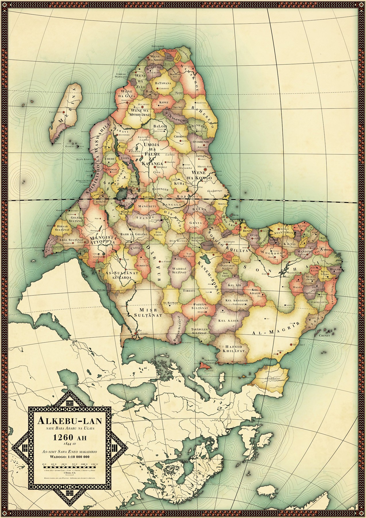
Todos los mapas mienten (Español / English) Soy un adicto a los mapas, y considero que por una u otra razón todos mienten. Aunque este podría ser una excepción en parte, ya que es un compendio de información histórica e imaginación del autor, y plantea una visión completamente diferente de cómo sería África si los europeos no hubiéramos bajado a incordiar y colonizar. ¿Miente? evaluándolo estrictamente, si. Pero si nos vamos por la vertiente imaginativa, se podría calificar de ficción y ¿se puede calificar de mentira la ficción? Ideado por el artista sueco Nikolaj Cyon, este mapa plantea cómo sería África hoy en día si el colonialismo europeo jamás hubiera aparecido por el continente africano. (Las fronteras actuales de África fueron determinadas en gran medida por el colonialismo, que aún hoy siguen creando muchos y muy graves problemas). Cyon dibujó estas fronteras basándose en un estudio de las unidades políticas y tribales en 1844, la víspera de la "lucha por África" de Europa. Lo orientó con el sur en la parte superior para invertir la orientación tradicional de Europa en la parte superior. Información cedida por https://www.cyon.se/#/alkebulan-1260-ah/ En la página se pueden adquirir los mapas realizados para el proyecto. #mapa #ficcion #geografia #africa English I am a map addict, and I consider that for one reason or another all maps lie. This one might be an exception in part, though, as it is a compendium of historical information and the author's imagination, and it presents a completely different vision of what Africa would be like if we Europeans hadn't come down to raid and colonise. Is the map lying? Strictly speaking, yes. But if we go for the imaginative side, it could be qualified as fiction, and can fiction be qualified as a lie? Devised by Swedish artist Nikolaj Cyon, this map depicts what Africa would look like today if European colonialism had never appeared on the African continent. (Africa's current borders were largely determined by colonialism, which still creates many very serious problems today). Cyon drew these borders based on a survey of political and tribal units in 1844, the eve of Europe's "scramble for Africa". He oriented it with the south at the top to reverse Europe's traditional orientation at the top. Information courtesy of https://www.cyon.se/#/alkebulan-1260-ah/ Maps produced for the project are available for purchase on the site. #map #geography #fiction #africa
No comments yet